Explore
Featured
Recent
Articles
Topics
Login
Upload
Featured
Recent
Articles
Topics
Login
Upload
Search Results for 'Raster-Gis'
Raster-Gis published presentations and documents on DocSlides.
Understanding Vector and Raster
by liane-varnes
DataTitle. Larry C. . Shubat. Professor. The Univ...
Raster Graphics 2.01 Understand Digital Raster Graphics
by celsa-spraggs
Raster Graphics. Also called . bitmap . graphics ...
Raster GIS
by marina-yarberry
Objectives. To review the definition of raster GI...
Compressing Imagery and Building a Raster Mosaic Dataset
by sherrill-nordquist
Ken Carrier, . GISP. Senior GIS Specialist. Strat...
Geographic Information Systems
by ellena-manuel
Department of Surveying and . Geomatics. By Shoko...
GIS and Network Analyst A. Goodchild
by jane-oiler
CEE 587. 25 . April . 2011. What is GIS?. Geograp...
Spatial Thinking and the GIS User Interface
by natalia-silvester
Michael F. Goodchild. University of California. S...
Lesson 3 GIS Fundamentals
by lois-ondreau
MEASURE Evaluation. PHFI Training of Trainers. Ma...
Winter 2011 GIS Institute
by tawny-fly
Space:. Questions & Tools. First Off: Introdu...
GIS (Geographic Information Systems)
by ellena-manuel
Applications in marketing. Austin College. April ...
GIS Matthew Rosencrans
by test
Tom . DiLiberto. Outline . What is GIS?. What can...
Working with Raster Grids and Map Algebra
by mitsue-stanley
Katherine Paybins, USGS. Basic Ingredien. ts. Gri...
S patial Analysis: Raster
by marina-yarberry
Rasters. are . beautiful.. Rasters. don’t dep...
Raster Analysis
by test
Apr. 5. th. , 2017. Wenwen Zhang. CP6514/Spring 2...
Intro to Spatial Analysis with
by luanne-stotts
What can we do with GIS?. SPATIAL STATISTICS. Wha...
RNR 419/519
by yoshiko-marsland
Introduction to . Cartographic Modeling . Analysi...
Esri’s ArcGIS Enterprise
by luna
IT4GIS. Keith T. Weber, GISP. GIS Director. ISU-GI...
Unit 2 Data Processing & Management
by nicole
TYIT SEM VI. D. ata processing system. Refers . to...
Solar Energy Analysis with
by tatyana-admore
ArcMap. . GIS Club at UWM. Greg Latsch. March 27...
9. GIS Data Collection
by tawny-fly
Overview. Introduction. Primary data capture. Sec...
How to make flash cards out of PowerPoint slides!
by tatyana-admore
See slide 8 for details. 1. Which one of these ca...
Lecture 2:
by kittie-lecroy
Part 1. Understanding Spatial Data Structures. Pa...
GEO 241: Geographic Information Systems I
by luanne-stotts
Week 8. : . R. aster Data Model. G...
An Introduction to GIS
by myesha-ticknor
Karen Hogenboom (with thanks to Leo Dion). Numeri...
Geographic Information Systems (GIS) – climate hazards
by valerie
Getting started. You’ll need a notepad on which ...
Treatment of Imatinib -resistant GIST
by beatrice
: . The Next Generation. Dr. Michael Heinrich, M....
A GIS-Based Model to Assess
by fanny
Onsite Sewage . Facility . (. OSSF) . Contaminatio...
Minnesota DNR GIS Service Delivery and Governance
by candy
Tim . Loesch. GIS Section Manager. Camp Ripley. 19...
Use of GIS a s a Decision Support System
by belinda
GEOM 4008 - November 2, 2015. Group 2 : Fernanda ....
GIS for Information Technology
by helene
Prepared by . Information . Technology Services . ...
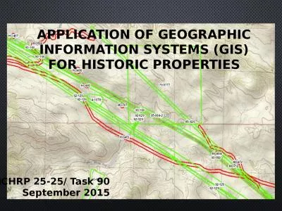
APPLICATION OF GEOGRAPHIC INFORMATION SYSTEMS (gis) FOR Historic properties
by teresa
NCHRP 25-25/ Task 90. September 2015. What is a GI...
Role of GISFI in Global Standardization
by caitlin
Ramjee Prasad . Founding Chairman, GISFI. www.gisf...
Michigan Statewide 911 GIS Repository
by fiona
Data Importer Onboarding Training. Mark Holmes, GI...
A GIS case study Adeline’s dilemma
by heavin
July 29, 2012. James . Daw. Adeline, age 66. Inco...
GIS Quick Tips
by eleanor
Presented by CUC ’ s Uivision of Heart Uisease a...
GIS for NG911 May 18 th , 2022
by Dollface
Thurston County Fairgrounds. Jason Guthrie 360-70...
Kansas NG9-1-1 GIS Data Model
by SupremeGoddess
Model Standards and Data Remediation Workshop. Wel...
GIS MAPPING AND VULNERABILITY ASSESSMENT
by roxanne
IN UPHCS OF MADURAI CORPORATION UNDER NUHM . Prese...
Ernesto Gismondi
by alyssa
12FebeDaniele MoioliFEBEERNESTO GISMONDI / DANIELE...
Remote Sensing and GIS Application
by blindnessinfluenced
Lecturer. Ruba. . Yousif. . Hussain. Third Year....
Load More...